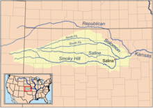
| name | image | Average flow (m³/s) | basin (m²) | Height (m) | origin location | mouth location | Length (m) | latitude (°) | longitude (°) | canyon | Map |
|---|---|---|---|---|---|---|---|---|---|---|---|
| Ladder Creek | 3,644,113,152 | Smoky Hill River | 370,000 | 38.7992000000 | -100.8600000000 | Map | |||||
| North Fork Smoky Hill River | 1,965,800,832 | Smoky Hill River | 314,000 | 38.9203000000 | -101.2810000000 | Map | |||||
| Saline River (Kansas) |  | 8,855,169,024 | Smoky Hill River | 639,000 | 38.8578000000 | -97.5061000000 | Map | ||||
| Solomon River |  | 17,702,567,936 | Smoky Hill River | 296,000 | 38.9036000000 | -97.3692000000 | Map | ||||
| Big Creek (Kansas) | 2,232,569,600 | Smoky Hill River | 356,000 | 38.7903000000 | -98.9194000000 | Map |