
| name | elevators | floors below ground | image | status | style | Area (m²) | type | use | date completed | Cost | Website | date Opened | date Start construction | Height (m) | city | administrative división | continent | Country | latitude (°) | longitude (°) | number of Floors | address | Map |
|---|---|---|---|---|---|---|---|---|---|---|---|---|---|---|---|---|---|---|---|---|---|---|---|
| Östervångsskolan | 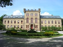 | 1871 | website | Lund | Skåne County | Europe | Sweden | 55.7000007629 | 13.1999998093 | Östervångsvägen | Map | ||||||||||||
| Domkyrkoforum |  | 11/2011 | website | Lund | Skåne County | Europe | Sweden | 55.7034666700 | 13.1931444400 | Kyrkogatan | Map | ||||||||||||
| Ideon Gateway |  | Completed | Various | 2013 | website | 2013 | 2010 | 74 | Lund | Skåne County | Europe | Sweden | 55.7166671753 | 13.2166662216 | 19 | Scheelevägen | Map | ||||||
| Karl XII-huset |  | 1500 | website | Lund | Skåne County | Europe | Sweden | 55.6996944400 | 13.1910527800 | Stora Södergatan | Map | ||||||||||||
| Kjederquistska gården |  | 1812 | website | Lund | Skåne County | Europe | Sweden | 55.7000007629 | 13.1833333969 | Bredgatan | Map |