| name | office head of government | Mayor | image | Area (m²) | date founded | Elevation (m) | Country | administrative division | continent | latitude (°) | waterbody | longitude (°) | Website | population (people) | Demonym | Map |
|---|---|---|---|---|---|---|---|---|---|---|---|---|---|---|---|---|
| Port Howard |  | 800,000,000 | 1866 | United Kingdom | Falkland Islands | Europe | -51.6166648865 | -59.5000000000 | website | 22 | Map | |||||
| Port Patterson | United Kingdom | Falkland Islands | Europe | -51.2914000000 | -60.5559000000 | website | Map | |||||||||
| Port San Carlos |  | United Kingdom | Falkland Islands | Europe | -51.4833335876 | -59.0499992371 | website | 25 | Map | |||||||
| Port Stephens, Falkland Islands | United Kingdom | Falkland Islands | Europe | -52.0971000000 | -60.8322000000 | website | 4 | Map | ||||||||
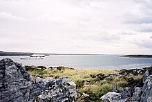
| Port William, Falkland Islands |  | United Kingdom | Falkland Islands | Europe | -51.6670000000 | -57.7860000000 | website | Map |