| name | office head of government | Mayor | image | Area (m²) | date founded | Elevation (m) | Country | administrative division | continent | latitude (°) | waterbody | longitude (°) | Website | population (people) | Demonym | Map |
|---|---|---|---|---|---|---|---|---|---|---|---|---|---|---|---|---|
| The Bottom |  | 550,000 | 272 | Netherlands | Saba | Europe | 17.6166667938 | -63.2333335876 | website | 462 | Map | |||||
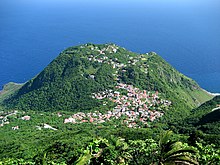
| Zion's Hill |  | 780,000 | 381 | Netherlands | Saba | Europe | 17.6333332062 | -63.2166671753 | website | 283 | Map | |||||
| Saba |  | 13,000,000 | 10/10/2010 | Netherlands | Saba | Europe | 17.6333332062 | -63.2500000000 | website | 1,915 | Map | |||||
| Windwardside |  | 400 | Netherlands | Saba | Europe | 17.6166667938 | -63.2166671753 | website | 418 | Map |