
| name | office head of government | Mayor | image | Area (m²) | date founded | Elevation (m) | Country | administrative division | continent | latitude (°) | waterbody | longitude (°) | Website | population (people) | Demonym | Map |
|---|---|---|---|---|---|---|---|---|---|---|---|---|---|---|---|---|
| Bayanga | 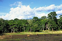 | 341 | Central African Republic | Sangha-Mbaéré | Africa | 2.8833334446 | 16.3166675568 | website | 4,000 | Map | ||||||
| Nola, Central African Republic |  | 442 | Central African Republic | Sangha-Mbaéré | Africa | 3.5333333015 | 16.0666675568 | website | 29,181 | Map | ||||||
| Adoumandjali | Central African Republic | Sangha-Mbaéré | Africa | 3.4268810000 | 15.8691600000 | website | Map | |||||||||
| Aloba | Central African Republic | Sangha-Mbaéré | Africa | 3.4666670000 | 15.9500000000 | website | Map | |||||||||
| Ambassilo | Central African Republic | Sangha-Mbaéré | Africa | 3.0833330000 | 16.2333329000 | website | Map |