| island | name | image | type | Area (m²) | Depth (m) | Height (m) | continent | waterbody | latitude (°) | Length (m) | longitude (°) | volume (m³) | Width (m) | Map |
|---|---|---|---|---|---|---|---|---|---|---|---|---|---|---|
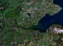
| Firth of Forth |  | Estuary | 46 | Europe | North Sea | 56.1666679382 | -2.7500000000 | Map | ||||||
| Firth of Tay |  | Estuary | Europe | North Sea | 56.4333343506 | -3.0000000000 | 4,800 | Map | ||||||
| Thames Estuary |  | Estuary | Europe | North Sea | 51.5000000000 | 0.5833333135 | Map | |||||||
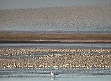
| The Wash |  | Estuary | 625,000,000 | Europe | North Sea | 52.9166679382 | 0.2500000000 | Map | ||||||
| Drammensfjord |  | Fiord | 117 | Europe | North Sea | 59.7000007629 | 30,000 | 10.3000001907 | Map |