| name | image | Country | continent | Depth (m) | waterbody | latitude (°) | Length (m) | longitude (°) | Minimum width (m) | Width (m) | Map |
|---|---|---|---|---|---|---|---|---|---|---|---|
| Fehmarn Belt | Germany | Europe | 54.5816000000 | 11.3189900000 | Map | ||||||
| Fehmarnsund |  | Germany | Europe | 54.3997222200 | 11.1169444400 | Map | |||||
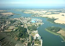
| Peenestrom |  | Germany | Europe | 54.0666656494 | 20,000 | 13.7833337784 | Map | ||||
| Strelasund |  | Germany | Europe | 16 | Baltic Sea | 54.2833328247 | 13.1166667938 | Map |