| material | name | light characteristic | heritage designation | image | tower shape | date Automated | date completed | date Opened | date Start construction | waterbody | Focal height (m) | Height (m) | date retired | Country | continent | latitude (°) | longitude (°) | Range (m) | Governing_body | administrative división | city | Map |
|---|---|---|---|---|---|---|---|---|---|---|---|---|---|---|---|---|---|---|---|---|---|---|
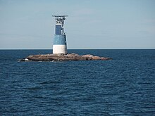
| Ölands södra grund | LFl W 8s |  | 1951 | Baltic Sea | 33 | 35 | Sweden | Europe | 56.0695833300 | 16.6805555600 | 14,484 | Kalmar County | Mörbylånga Municipality | Map | ||||||||
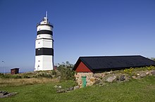
| Örskär |  | 1978 | 30/10/1969 | 1684 | 1740 | Baltic Sea | Sweden | Europe | 60.5166664124 | 18.3666667938 | Uppsala County | Östhammar Municipality | Map | |||||||||
| Almagrundet | LFl(3) WRG 30s |  | 1964 | 1964 | 1896 | 1964 | Baltic Sea | 28 | 44 | Sweden | Europe | 59.2666664124 | 19.5166664124 | 20,921 | Stockholm County | Värmdö Municipality | Map | |||||
| Bogskär |  | Baltic Sea | Finland | Europe | 59.5000000000 | 20.3333339691 | Åland Islands | Kökar | Map | |||||||||||||
| Dornbusch Lighthouse | Fl WR 10s | architectural heritage monument in Mecklenburg-Vorpommern |  | 1887 - 1888 | 1888 | 1887 - 1888 | Baltic Sea | 95 | 28 | Germany | Europe | 54.5833320618 | 13.1166667938 | 40,234 | Mecklenburg-Vorpommern | Hiddensee | Map |