| material | name | light characteristic | heritage designation | image | tower shape | date Automated | date completed | date Opened | date Start construction | waterbody | Focal height (m) | Height (m) | date retired | Country | continent | latitude (°) | longitude (°) | Range (m) | Governing_body | administrative división | city | Map |
|---|---|---|---|---|---|---|---|---|---|---|---|---|---|---|---|---|---|---|---|---|---|---|
| Cobb Point Bar Light | Fl G 4s |  | Hexagonal | 1889 | 1889 | Potomac river | 19 | 1940 | 38.2333335876 | -76.8166656494 | Map | |||||||||||
| Fort Washington Light | Fl R 6s |  | Pyramidal | 1954 | 1882 | 1901 | 1882 | Potomac river | 29 | 9 | 38.7000007629 | -77.0333328247 | 12,875 | Map | ||||||||
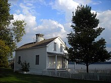
| Jones Point Light | place listed on the National Register of Historic Places |  | Conical | 1919 | 1856 | Potomac river | 1926 | Brazil | Americas | 38.7833328247 | -77.0333328247 | Minas Gerais | Virginia | Map | ||||||||
| Lower Cedar Point Light | FI G 2.5 s | Square | 1867 | Potomac river | 12 | 1951 | United States | Americas | 38.3333320618 | -76.9833297729 | Maryland | Newburg | Map | |||||||||
| Maryland Point Light | FI W 6s, R sector | Hexagonal | 1954 | 1892 | Potomac river | 13 | 1963 | United States | Americas | 38.3333320618 | -77.1833343506 | Virginia | King George, Virginia | Map |